Victor Cripple Creek

20 10 2008

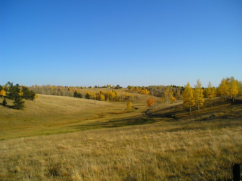
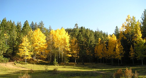
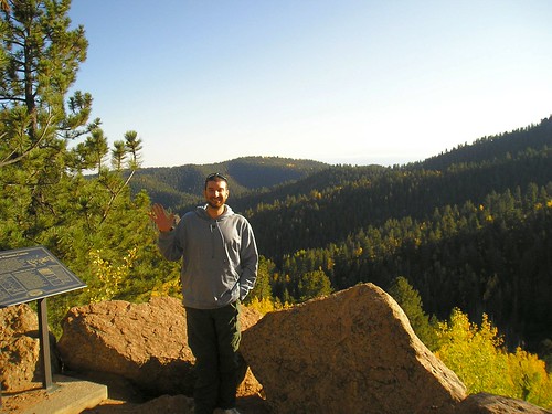
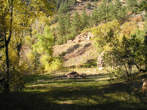
Once we reached about 10,000 feet elevation all of a sudden the terrain abruptly changed. I am not sure if this is altitude related or not, but the forest just gave way to a meadow. Webb pointed out that it reminded him a lot of Tennessee farms.

Victor, Colorado is a mining town of less than 500 residents currently. In the late 1800’s the town was booming with prospectors and miners. The history of the town is quite interesting, you can read more if you follow the link.  History of Victor, Colorado

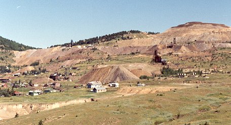
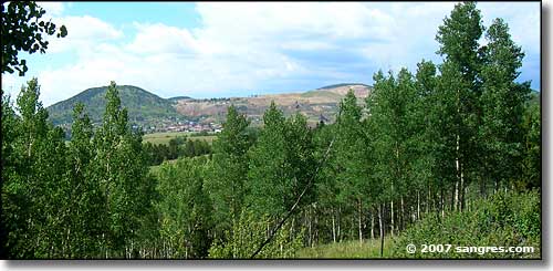
This is a distant view of Victor, Colorado. The town sits below the tailings of a former large gold mine. This reminds me of mountain top removal mining in KY, the entire mountain in some areas seemed to be nothing but a pile of rubble, and often we know that these areas are poisoned with heavy metals and other waste from the gold mines. To continue the similarities the leftover rubble from the mines are often dumped into valley fills. Below is a photo of one of the mines near Victor and Cripple Creek.

Notice the similarities to Mountaintop Removal mining in Appalachia.

History of Cripple Creek Colorado

Cripple Creek, Colorado was once a city of 50,000 during the Gold Rush years. Now limited stakes gaming has been approved to bring in income to the region.  While in Cripple Creek Webb and I stopped into a little shop and noticed this extremely disturbing sign…

Since it was getting dark and late we decided to drive Northeast to Colorado Springs to access an actual paved highway. We came around the Western side of Pikes Peak through Woodland Park. Below is an image of Pikes Peak viewed from Woodland Park, Co.


Phantom Canyon part deux

18 10 2008

ore photos from our recent trip through Phantom Canyon, CO! In this part of the canyon we are starting to really get up there in elevation.  Canon City is 5,332 ft.  The road climbs slowly, but for reference at the end of the road we are at nearly 10,000 ft.

A picture of our SUV (gas-guzzler 🙂 ) on the side of the road, looks like a commercial. Ford trucks!!!

We found this strange pit mysteriously near the roadside. Don’t know what it’s purpose was.  Mostly I just hoped no one ever fell in, because it was filled with nastiness. There was nothing around to explain what this thing was doing out here in the middle of NOWHERE.

Webb dont JUMP!!!

Webb don't JUMP!!!

As you can see…nastiness…

This is the only remaining original bridge along this road.

Yes those are wooden planks…

More road through the canyon.

A view from the side of the road, one of the many many times we abruptly halted our ascent to take photographs. It took us well over 2.5 hours to complete this trip one-way, but we stopped A LOT. At this point the temperature is dropping quite a bit the higher we go.  The difference between beginning and destination temps was 58-35 degrees F. The leaves at the lower elevations haven’t begun to change, but here the leaves are in full swing. (about 7000 feet)

These are Quaking Aspen. They grow in colonies and share a root system.

There were signs along the road marking where towns used to be during the gold rush.  All of these towns have since disappeared without a trace.

More aspen…

As you know this area of Colorado is famous for it’s major fossil discoveries including a practically complete stegosaurus fossil.  Amazingly we discovered perfectly preserved dinosaur remains in the woods!!!

Poor Barney…

The view at almost 9,000 feet.  You can see the road we drove in on down below as well and the Aspen which tend to follow the creek bed.  Amazingly it is entirely possible that ALL of the yellow Aspens you see in this photo are part of a single root structure.

Of course, Webb waves at the camera from the scenic overlook. It is cold so we keep our hands in our pockets.


Phantom Canyon

16 10 2008

Finally a trip up Phantom Canyon!!!

Here’s some information about the tour from Sangres.com which has a lot of pictures and info about the gold Belt Tour and the surrounding area. This was a great resource for us while planning this trip.

Phantom Canyon Road was built to connect Florence, CO to the mines in Cripple Creek and the surrounding area. From 1894 to 1912, railroad cars filled with gold ore rolled down Phantom Canyon feeding up to nine processing mills running day and night in Florence.

It was 1890 when Bob Womack made the gold strike that started the Cripple Creek Gold Rush. Since that time, more than 500 mines in the Cripple Creek and Victor Mining District have produced over 21 million ounces of gold – more than the Alaska and California Gold Rushes put together. Gold is still being produced in the District.

The terrain begins in the dessert-like scrub and makes some pretty intense transitions to thick evergreen and aspen cover and then to meadow up around 10,000 feet.

The majority of the land along this route is owned by the Bureau of Land Management particularly on the lower portion of the road. Since 1996, Phantom Canyon has been designated an Area of Critical Environmental Concern by the Bureau of Land Management.

Here is a shot as we are entering the canyon as the blacktop becomes a dirt road. The green you see to the right is the path of the creek which carved this canyon. At the time the creek is barely 3 feet wide and patchy (even following a pretty recent rainfall) but there are numerous reports of 30 foot flash floods racing down the canyon.

There are two tunnels along this route, the Upper and Lower Tunnel. The entire road is a converted narrow-gauge railroad path.

Lower Tunnel

There are some pretty steep drops, especially as you emerge from the upper Tunnel.

Upper Tunnel

This next picture shows one of the cuts blasted out for the railway.  There is literally only room for one car here, and just beyond there is a sharp curve and STRAIGHT down.  We were very fortunate to encounter another truck just as we emerged from this spot…of course we took the right side allowing the oncoming vehicle to risk sliding off the edge.

Notice how the trees have changed to evergreens…big tall ones!

From the Gold Belt Tour Website

From the Gold Belt Tour Website

Up further we pulled off and explored some of the camping, hiking in the area and found this creek and large fire pit.